Basic Leaflet
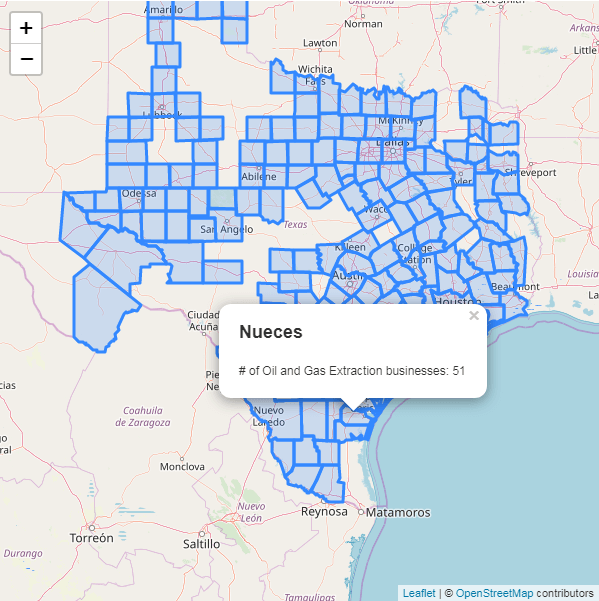
This example shows how to setup a leaflet map with popup on features when clicked. See the completed example here.
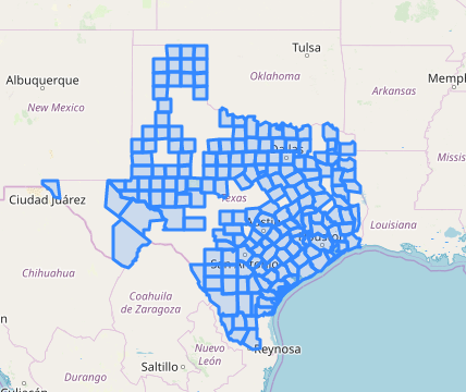
The data used is the number of Oil and Gas Extraction businesses for counties in Texas, via the County Business Patterns (CBP API). The api uses North American Industry Classification System (NAICS), for Oil and Gas Extraction the NAICS is 211.
Setting up
In the head import libraries and styles. You can download citysdk.js here or build it using browserify.
<link
  rel="stylesheet"
  href="https://unpkg.com/leaflet@1.5.1/dist/leaflet.css"
/>
<script src="https://unpkg.com/leaflet@1.5.1/dist/leaflet.js"></script>
<script src="./citysdk.js"></script>
In the body setup a container with an id of map, with a height and width.
<style>
  #map {
    height: 600px;
    width: 600px;
  }
</style>
<div id="map"></div>
In a script tag after the map div, we initialize the map. First by calling L.map("map") on the map div id, then running .setView([31.6623, -99.0306], 6) to set the center and zoom level. Next we add OpenStreetMap as a base title layer.
var map = L.map('map').setView([31.6623, -99.0306], 6);
L.tileLayer('https://{s}.tile.openstreetmap.org/{z}/{x}/{y}.png', {
attribution:
'© <a href="https://www.openstreetmap.org/copyright">OpenStreetMap</a> contributors'
}).addTo(map);
Query and add data
We use CitySDK to query for the geojson and values. Then add the layer by calling L.geojson().addTo() and passing in the response as a CitySDK callback.
census(
  {
    vintage: 2016,
    geoHierarchy: {
      state: 48,
      county: '*'
    },
    geoResolution: '500k',
    sourcePath: ['cbp'],
    predicates: {
      NAICS2012: 211 // NAICS code for Oil and Gas Extraction
    },
    values: ['ESTAB'] // number of establishments
  },
  function(error, response) {
    L.geoJson(response).addTo(map);
  }
);
Adding popup
To add a popup when a county is clicked we modify the L.geoJson function with an additional object as an argument. This object contains a key of onEachFeature, and a value of a function that will be run on each feature to bind a popup when clicked. The contents of the popup will the feature properties which contains the name of county and number of establishments.
L.geoJson(response, {
  onEachFeature: function(feature, layer) {
    layer.bindPopup(
      '<h2>' +
        feature.properties.NAME +
        '</h2><p># of Oil and Gas Extraction businesses: ' +
        feature.properties.ESTAB +
        '</p>'
    );
  }
}).addTo(map);